
onX Hunt: Offline Hunting Maps review
 Analysis by GetAllApps
I think onX Hunt makes the most sense when hunting plans involve more than picking a spot on a map. It is a sports app from onXmaps built around the details that can matter once you leave the road: terrain, property boundaries, navigation, and the ability to prepare maps for a trip. In my experience, that focus is useful for a household or hunting group sharing plans, but it also calls for clear boundaries about whose account and device are being used.
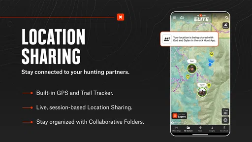
Planning together without passing one phone around
A common trip-planning problem is that one person has the map open while everyone else is trying to understand where to meet, which route to take, or whether a proposed location is on the right side of a boundary. onX Hunt is designed to bring several kinds of map information into the planning process, so I would use it before the trip to inspect an area and agree on a plan rather than relying on a quick glance at a screen in the field.
That distinction matters in a shared-use household. A parent might plan a route on their own device, then talk through the location with another adult or an older teenager. I would not assume that “shared use” means handing over a single login or that the app has family-management tools. Instead, decide who is responsible for the account, who will carry a charged phone, and how the group will communicate if people separate.
The app is free to install, and it has a 4.5 average from around 65,000 ratings. Those figures suggest it has reached many people, but they do not tell me whether its map coverage suits a particular hunting area. I would check the places I actually plan to visit before making it central to a trip.
Set up the map before leaving home
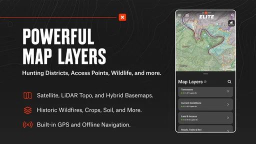
The most useful habit is to treat preparation as part of the outing. Look over the intended area while you have time to compare terrain with property lines, then decide what information you need visible. Map layers can make a screen more informative, but adding every available layer at once can also make it harder to read. I prefer to start with the details that answer a practical question—where the boundary runs, how the terrain changes, or which way a route should go—and adjust from there.
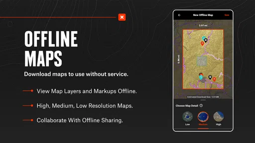
Offline maps are especially relevant when a route may take you beyond reliable mobile coverage. I would save the area I expect to use before setting out, then check that it is available on the phone I will carry. That small check is easy to overlook when planning at home, yet it can prevent an avoidable scramble in the field. An offline map is a useful preparation step, not a substitute for a charged device, sensible navigation, or a backup plan.
There is also a household boundary worth keeping in mind: a map saved on one phone does not automatically mean every person in the group has the same preparation. If another adult or family member is expected to navigate, have them review the route on their own device or make sure they know the agreed plan. I would not assume that map downloads, account details, or settings are shared across devices unless I had checked how my own setup works.
Coordinate around boundaries, not assumptions
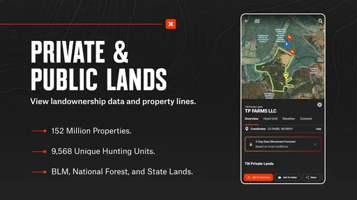
Property lines are one of the app’s most consequential tools, but they should be treated as planning information rather than permission to enter. Before a trip, I would use the map to identify where a proposed route approaches a boundary and discuss how the group will avoid crossing it unintentionally. If a line looks unclear or a situation on the ground does not match the screen, stopping to reassess is wiser than pressing on because a phone appears certain.
This is a practical advantage over a basic navigation app that focuses mainly on roads and general directions: onX Hunt is aimed at a hunting context, where land boundaries and terrain can change the decision. At the same time, it is not a replacement for local knowledge or direct confirmation when access is uncertain. A digital line can help you ask better questions; it should not be treated as a blanket guarantee that a route is appropriate.
For coordination, I would agree on a meeting point and a simple fallback before anyone walks away from the group. That is useful even when everyone has a map, because phones can lose power, become difficult to use in poor conditions, or be carried by the person who is temporarily out of reach. The app helps with the map side of a plan; the group still needs a clear human plan for regrouping.
Account ownership and age expectations
onX Hunt is rated for Everyone, so its listed age context is broad. That does not mean every hunting trip or every use of navigation is suitable for every child. I would judge participation by maturity, the environment, and whether an adult can supervise—not by the rating alone. A younger family member might benefit from learning how to read a map with an adult, while independent navigation in unfamiliar country calls for much more care.
The app is developed by onXmaps and has been available since November 8, 2013. It has more than five million installs, which indicates a substantial user base, but household decisions are still personal: one family may use it for an experienced adult’s field planning, while another may want to keep access to devices and accounts tightly managed. I would make the responsible adult the account owner and avoid sharing passwords casually, especially when several people use the same phone.
There is no reason to treat a child’s access as a substitute for supervision. If a younger person is carrying the device, I would explain what the map can and cannot establish, keep the planned route understandable, and make sure they know what to do if the group gets separated. These are sensible limits for any navigation tool, and they are particularly important when the app is being used outside familiar places.
Where the free app fits—and where it may not
The app is free, but in-app purchases range from $9.99 to $99.99 per item. I would check what is included for the locations and functions I need before building a plan around paid capabilities. The range is broad enough that a household should discuss purchases rather than assume that everyone can access the same tools at no cost. If one person is paying, make clear which device or account is intended to use what.
For someone who only wants ordinary road directions or a simple trail overview, a general mapping app may be easier and cheaper to manage. onX Hunt is a better fit when hunting-specific planning—particularly property boundaries, terrain, and map layers—is central to the decision. It is less compelling if you rarely hunt, do not need that level of land detail, or would rather use a paper map and local guidance than manage an app and its purchases.
One trade-off is that more map information is not automatically better. A dense view can slow down decisions if the user has not learned which layer answers which question. I would take a few minutes at home to explore the display, then keep the field view focused. A second trade-off is reliance: offline preparation helps with weak coverage, but the phone itself remains a device with limited battery and a screen that can be awkward to consult while moving. Carrying a backup navigation method is a sensible choice for demanding trips.
My household verdict
I would recommend onX Hunt to a household with an active hunter who wants to plan routes and review land boundaries with more context than a standard map usually provides. Its strongest role is preparation: examine the area, think through access, save what will be needed offline, and make sure the people joining the trip understand the plan. That workflow can make coordination calmer without pretending the app replaces communication or judgment.
I would skip it for a family that needs only casual directions, or for anyone expecting a map to settle access questions on its own. The purchase range also makes it worth checking the cost of the specific tools you want before committing. With one responsible account holder, clear device expectations, and a backup plan for the field, I find it a useful specialist tool rather than an all-purpose household map.
Overall, the name onX Hunt is most convincing when the details of land and terrain shape where you can go. I like that it supports planning before signal becomes a concern, but I would keep its role grounded: it informs decisions, while people remain responsible for boundaries, safety, and coordination. For a hunting household that values those details, that is a practical balance.
Pros and cons
Pros
- Offline maps remain available when cell service is unreliable.
- Hunting boundaries help you identify nearby property lines.
- Custom waypoints make it easier to mark camps and stand locations.
- Public land information can help you plan where to hunt.
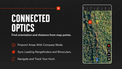
- GPS tracking lets you review your route in the field.
Cons
- Many advanced map layers require a paid membership.
- Offline maps need to be downloaded before you lose service.
- Map accuracy can vary by location and data source.
- Frequent map downloads can use substantial phone storage.
- GPS use can drain your battery during long outings.


